





Advanced geospatial solutions for analyzing cities, services, and resources, while supporting planning and decision-making.
Examples of Geographic Information Systems (GIS), Spatial Analysis, and Remote Sensing Projects

This portfolio includes a specialized range of projects based on Geographic Information Systems (GIS), spatial analysis, remote sensing, and geodatabase management. The applications cover development indicator analysis, assessment of the distribution of healthcare and public services, urban growth monitoring, updating base maps, spatial equity analysis, geological hazard assessment, and evaluation of the efficiency of services and infrastructure.
The projects relied on integrating spatial and statistical data, satellite imagery, road networks, elevation models, and field data within comprehensive analytical environments.
The portfolio also includes advanced applications in land use and spatial change analysis, urban growth modeling, Multi-Criteria Decision Analysis (MCDA), optimal site selection, spatial statistical analysis, Web GIS, dashboards, and urban settlement analysis, in addition to the development of decision-support platforms.
The deliverables include spatial databases, analytical and thematic maps, performance indicators, future scenarios and models, interactive applications, and technical reports that support planning and the effective management of development, risks, and public services.
Advanced geospatial solutions for analyzing cities, services, and resources, while supporting planning and decision-making.
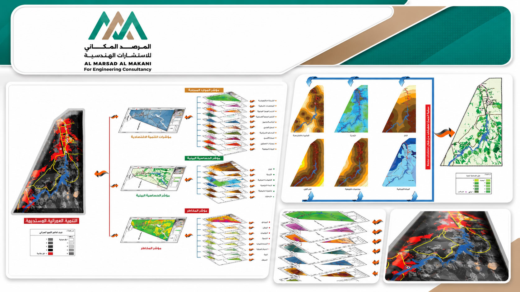
Development of a Comprehensive Development Indicators Application for Aswan Governorate
- Project TypeGeographic Information Systems (GIS), Development Indicator Analysis, and Regional Planning
- LocationAswan Governorate – Arab Republic of Egypt
- Project DescriptionA specialized project focused on measuring and analyzing comprehensive development indicators and identifying development priorities across Aswan Governorate. The scope included collecting and preparing spatial and statistical data, developing a geodatabase, and classifying areas according to their development priorities. The project also included preparing geographic indicator maps, analyzing the spatial distribution of development gaps, and applying Multi-Criteria Decision Analysis (MCDA) to support prioritization and planning. The outputs included interactive dashboards, maps, analytical reports, and indicators to support decision-making, as well as the development of a GIS-based application to support investment and development priorities and improve planning processes.
Advanced geospatial solutions for analyzing cities, services, and resources, while supporting planning and decision-making.
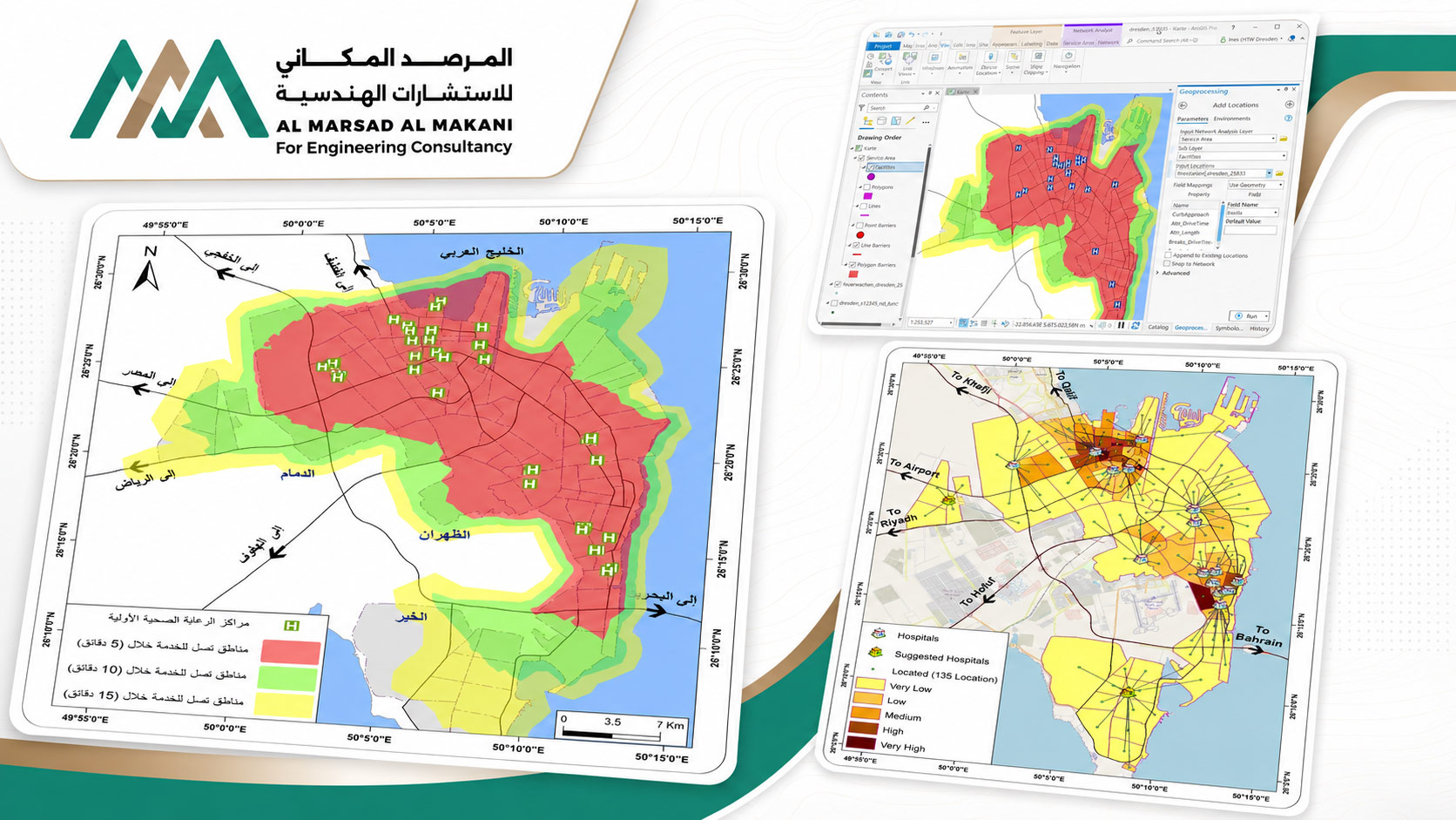
Assessment of Healthcare Services in the Dammam Metropolitan Area – Kingdom of Saudi Arabia
- Project TypeGIS-Based Assessment of the Spatial Distribution and Efficiency of Healthcare Services
- LocationDammam Metropolitan Area – Kingdom of Saudi Arabia
- Project DescriptionA study to evaluate the efficiency and spatial equity of healthcare service distribution, measure population accessibility to hospitals and healthcare centers, and identify service gaps and areas of need. The project included developing a geographic database covering healthcare facilities, road networks, population distribution, administrative boundaries, land use, and service capacity. Spatial analyses were then conducted to assess service areas, accessibility, proximity, and population density. The scope also included GIS-based gap analysis and Multi-Criteria Decision Analysis (MCDA), resulting in maps showing healthcare service distribution and efficiency, underserved areas, performance indicators, and analytical applications to support planning and decision-making.
Advanced geospatial solutions for analyzing cities, services, and resources, while supporting planning and decision-making.
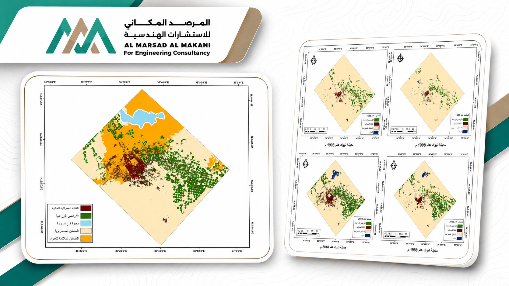
Urban Growth Modeling and Monitoring in Tabuk City
- Project TypeRemote Sensing, Change Analysis, and Urban Growth Modeling
- LocationTabuk – Kingdom of Saudi Arabia
- Project DescriptionA project focused on monitoring and analyzing urban changes in Tabuk City, modeling growth trends, and forecasting future urban expansion using multi-temporal satellite imagery. The scope included preparing land use maps, classifying land cover and land use, analyzing urban growth trends, and applying Change Detection techniques together with multi-criteria analysis. The study also incorporated road networks, elevation models, and population data. The project further included developing GIS-based urban expansion models, producing maps of urban change, growth patterns, and land use, and preparing forecasting models and applications to support future urban planning.
Advanced geospatial solutions for analyzing cities, services, and resources, while supporting planning and decision-making.
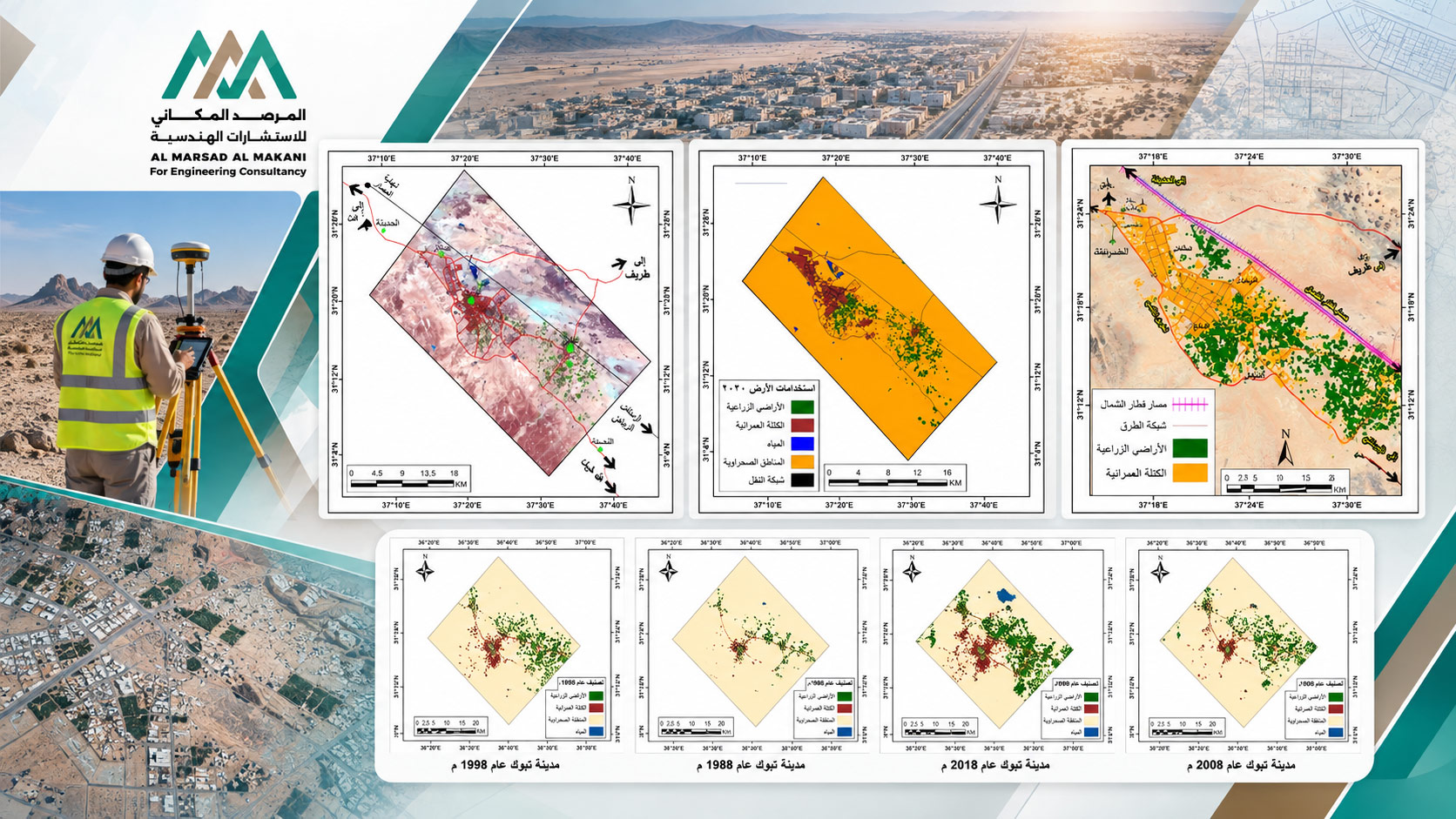
Updating the Base Map for Al Qurayyat and Al Hadithah Cities
- Project TypeBase Map Development, Surveying Works, Remote Sensing, and Map Updating
- LocationAl Qurayyat and Al Hadithah – Kingdom of Saudi Arabia
- Project DescriptionA project to update the base maps of Al Qurayyat and Al Hadithah and develop an accurate spatial database reflecting current conditions and supporting urban planning and infrastructure management. The scope included land surveying and field data collection, processing satellite and aerial imagery, updating map layers, analyzing and extracting ground features, and detecting spatial changes. The project also included integrating survey data with remote sensing data and preparing GIS-based reports, resulting in updated digital base maps, an integrated spatial database, maps of facilities and infrastructure, and related GIS applications.
Advanced geospatial solutions for analyzing cities, services, and resources, while supporting planning and decision-making.
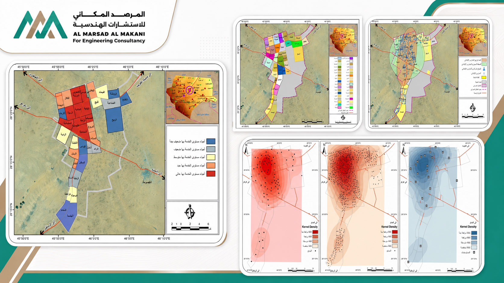
Spatial Equity Indicators for the Distribution of Public Services in Hafar Al-Batin City
- Project TypeSpatial Equity Analysis and Assessment of Service Distribution Efficiency
- LocationHafar Al-Batin – Kingdom of Saudi Arabia
- Project DescriptionA project aimed at measuring and evaluating the spatial equity of public service distribution in Hafar Al-Batin City and identifying spatial gaps, underserved areas, and areas of service deprivation. The study was based on the locations of public services, population distribution and densities, road networks, administrative boundaries, land use, and planning data. The scope included conducting service area, accessibility, proximity, gap, and Multi-Criteria Decision Analysis (MCDA), as well as measuring Spatial Equity Indicators. The project outputs included GIS-based spatial equity maps, maps identifying underserved areas, performance indicators, dashboards, planning support reports, and analytical applications to support decision-making and improve the efficiency and equity of public service distribution.
Advanced geospatial solutions for analyzing cities, services, and resources, while supporting planning and decision-making.
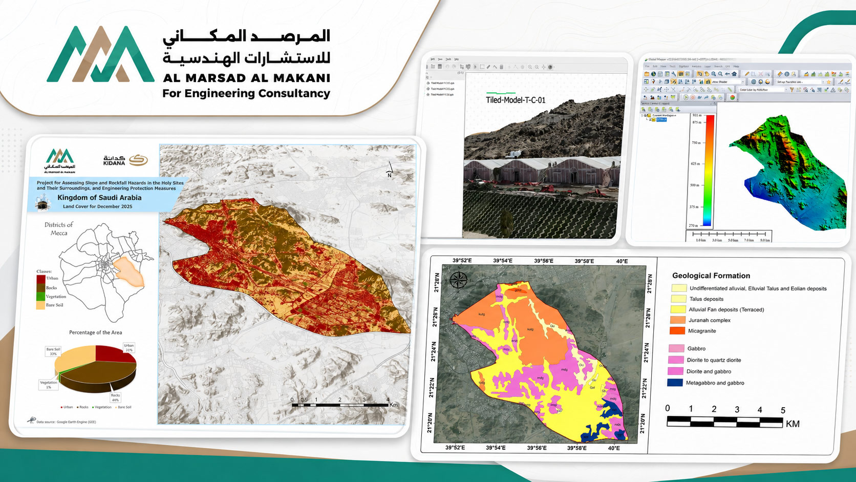
GIS Platform for Managing and Assessing Rockfall Hazards in the Holy Sites
- Project TypeGeodatabase – GIS – Web GIS – Dashboard for Geological Hazard Management
- LocationHoly Sites – Makkah
- BeneficiaryKIDANA Development Company
- Project DescriptionAn integrated project for managing and analyzing rockfall hazard data in the Holy Sites for KIDANA. The project combines the development of an Enterprise Geodatabase with the standardization and integration of field and spatial data, rockfall modeling results, GIS datasets, RMR and SMR classifications, geological maps, discontinuity data, DEM/DSM products, LiDAR models, geological survey data, and UAV-based survey outputs. The system provides hazard maps, monitoring stations, hazard levels, photographs, technical reports, and field data, together with advanced query and spatial analysis capabilities. The project also included the development of an integrated Web GIS and Dashboard platform to support geological hazard management, assessment, monitoring, analysis, and informed decision-making.
Advanced geospatial solutions for analyzing cities, services, and resources, while supporting planning and decision-making.
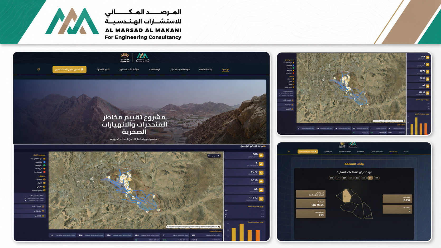
Assessment of Public Service Distribution Efficiency in Wadi Al-Dawasir City Using Geographic Information Systems
- Project TypeInteractive information dashboards for managing and analyzing rockfall hazards, Web GIS, development of a geographic database, and geospatial applications.
- LocationHoly Sites – Makkah – Kingdom of Saudi Arabia
- Project DescriptionAn integrated project for managing and analyzing rockfall hazard data in the Holy Sites through the development of a centralized geographic database linking field survey data, GIS data, rockfall simulation outputs, geological discontinuity results, and hazard monitoring data. The project also included developing a Web GIS platform and interactive dashboards to support monitoring and spatial analysis, as well as integrating DEM/DSM, LiDAR, and Drone data with geological and topographic maps and various data sources. The interactive information system enables users to display and analyze hazard locations, search for monitoring stations, classify sites according to hazard level, and display photographs, reports, and associated data. The platform provides an integrated environment to support monitoring, risk management, and decision-making.
Advanced geospatial solutions for analyzing cities, services, and resources, while supporting planning and decision-making.
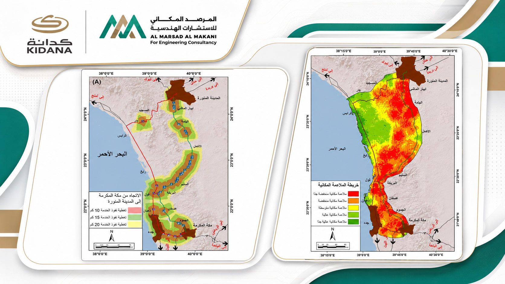
Assessment of Fuel Station and Service Center Efficiency in Makkah Using Geographic Information Systems
- Project TypeNetwork Analysis, Spatial Suitability Assessment, and Service Location Selection
- LocationMakkah – Kingdom of Saudi Arabia
- Project DescriptionA project to assess the efficiency of the spatial distribution of fuel stations and service centers, measure accessibility and service coverage, and identify optimal locations for new facilities. The study relied on road network data and applied AHP, MCA-GIS, Gap Analysis, Service Area Analysis, and Network Analysis, together with population and traffic density indicators, land use data, and environmental factors. The project also included Suitability Analysis and the production of maps showing distribution efficiency, service coverage areas, spatial suitability, proposed locations, performance indicators, and interactive dashboards.
Advanced geospatial solutions for analyzing cities, services, and resources, while supporting planning and decision-making.
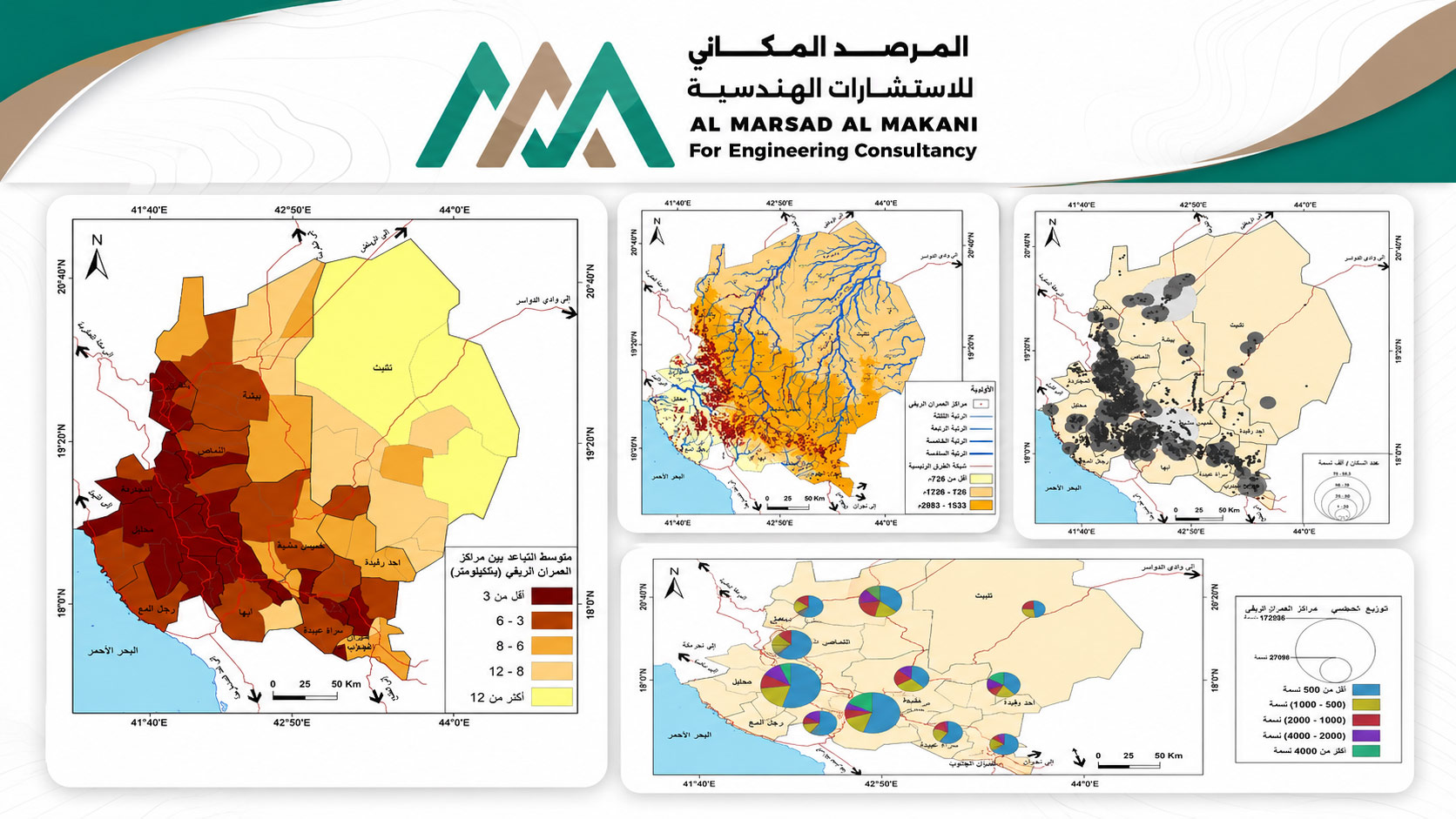
Spatial Distribution Pattern Analysis of Rural Settlement Centers in the Asir Region
- Project TypeStatistical and Spatial Analysis of Rural Settlements
- LocationAsir Region – Kingdom of Saudi Arabia
- Project DescriptionA study to analyze the spatial characteristics of rural settlement centers, including their distribution patterns, density, spatial dispersion, and the natural and human factors influencing them. The analysis was based on settlement locations, administrative boundaries, road networks, land use data, population and environmental datasets, and Digital Elevation Models (DEM). The study applied advanced spatial statistical techniques, including Average Nearest Neighbor, Kernel Density, Directional Distribution, Standard Distance, and Spatial Autocorrelation – Moran’s I. The outputs included maps of settlement distribution, spatial density and patterns, together with indicators supporting regional planning and the analysis of rural development trends.
Advanced geospatial solutions for analyzing cities, services, and resources, while supporting planning and decision-making.
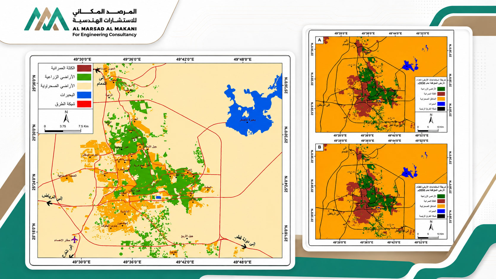
Spatial Change Modeling and Land Use Forecasting in Al-Ahsa Oasis
- Project TypeLand Change Analysis and Spatiotemporal Modeling
- LocationAl-Ahsa Oasis – Kingdom of Saudi Arabia
- Project DescriptionA project focused on monitoring and analyzing changes in Land Use and Land Cover (LULC) across Al-Ahsa Oasis and forecasting future scenarios using multi-temporal satellite imagery and LULC maps and models. The study applied Markov-CA, Suitability Analysis, multi-criteria analysis, and Land Change Modeler, integrating elevation data, road networks, and environmental, demographic, and planning datasets. The outputs included historical land change maps, spatial suitability analyses, future projections of land use and urban growth, and spatiotemporal change indicators to support planning and future development decisions.
Advanced geospatial solutions for analyzing cities, services, and resources, while supporting planning and decision-making.
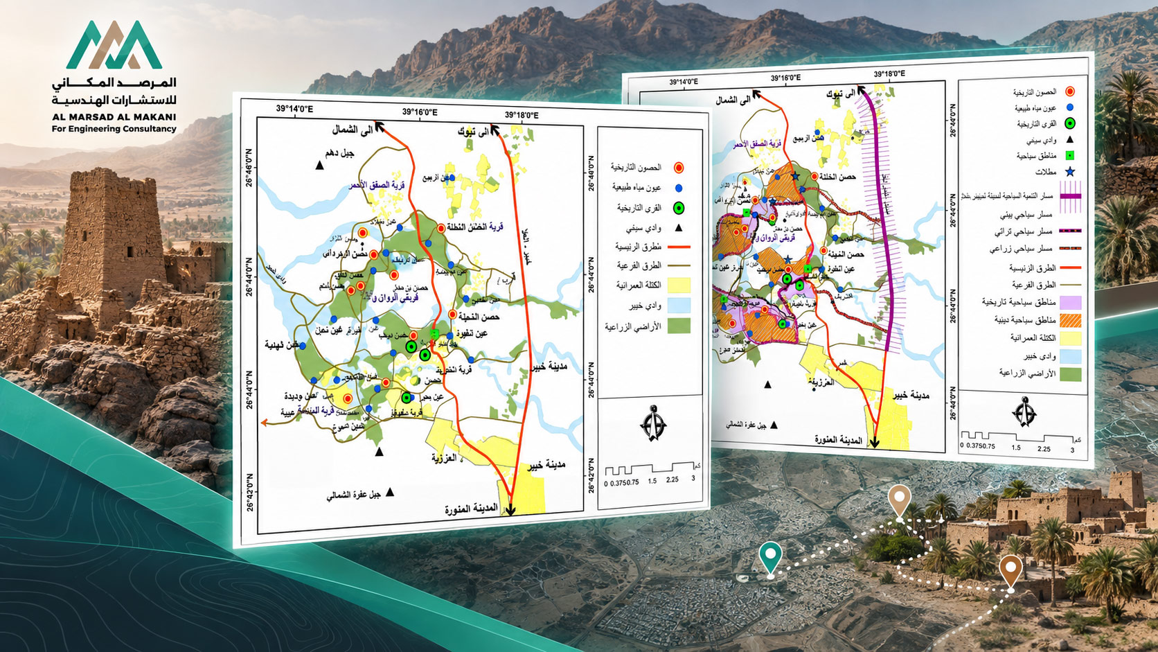
Spatial Tourism Planning and Analysis of Tourism Assets in Khaybar Using Geographic Information Systems
- Project TypeTourism Planning, Suitability Analysis, and GIS-Based Investment Assessment
- LocationKhaybar – Kingdom of Saudi Arabia
- Project DescriptionA spatial study aimed at assessing the natural and human assets that support tourism development, developing a geographic database for tourism and heritage sites, analyzing their spatial distribution and accessibility, and identifying priority areas for tourism development and investment. The study applied Suitability Analysis, Proximity Analysis, Accessibility Analysis, land-use data, administrative boundaries, planning datasets, and Digital Elevation Models (DEM) to evaluate tourism potential and investment opportunities. The analysis incorporated natural and heritage attractions, road networks, and surrounding spatial characteristics. The project also included the development of GIS dashboards, Geodatabase applications, and MCDA-GIS analyses, resulting in maps of tourism assets, investment suitability, accessibility, and priority development areas to support tourism planning and decision-making.
Advanced geospatial solutions for analyzing cities, services, and resources, while supporting planning and decision-making.
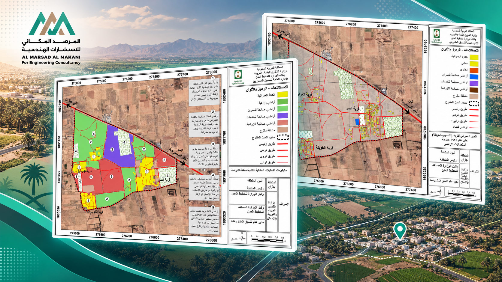
Urban Boundary Analysis and Spatial Characteristics of Residential Settlements in Ahad Al-Masarhah Governorate
- Project TypeUrban Analysis and Modeling and Delineation of Urban Boundaries
- LocationAhad Al-Masarhah Governorate – Kingdom of Saudi Arabia
- Project DescriptionA project focused on analyzing the spatial and urban characteristics of residential settlements and villages and delineating their urban boundaries in accordance with planning criteria, while assessing patterns of urban growth and expansion. The study relied on satellite imagery, aerial imagery, administrative boundaries, built-up areas, road networks, land-use data, and population and municipal datasets. It also included Urban Growth Analysis, Land Use Analysis, Urban Morphology, proximity analysis, and spatial connectivity analysis. The project outputs included maps of urban boundaries, built-up areas, land use, growth and expansion patterns, together with a comprehensive GIS geodatabase.
Advanced geospatial solutions for analyzing cities, services, and resources, while supporting planning and decision-making.
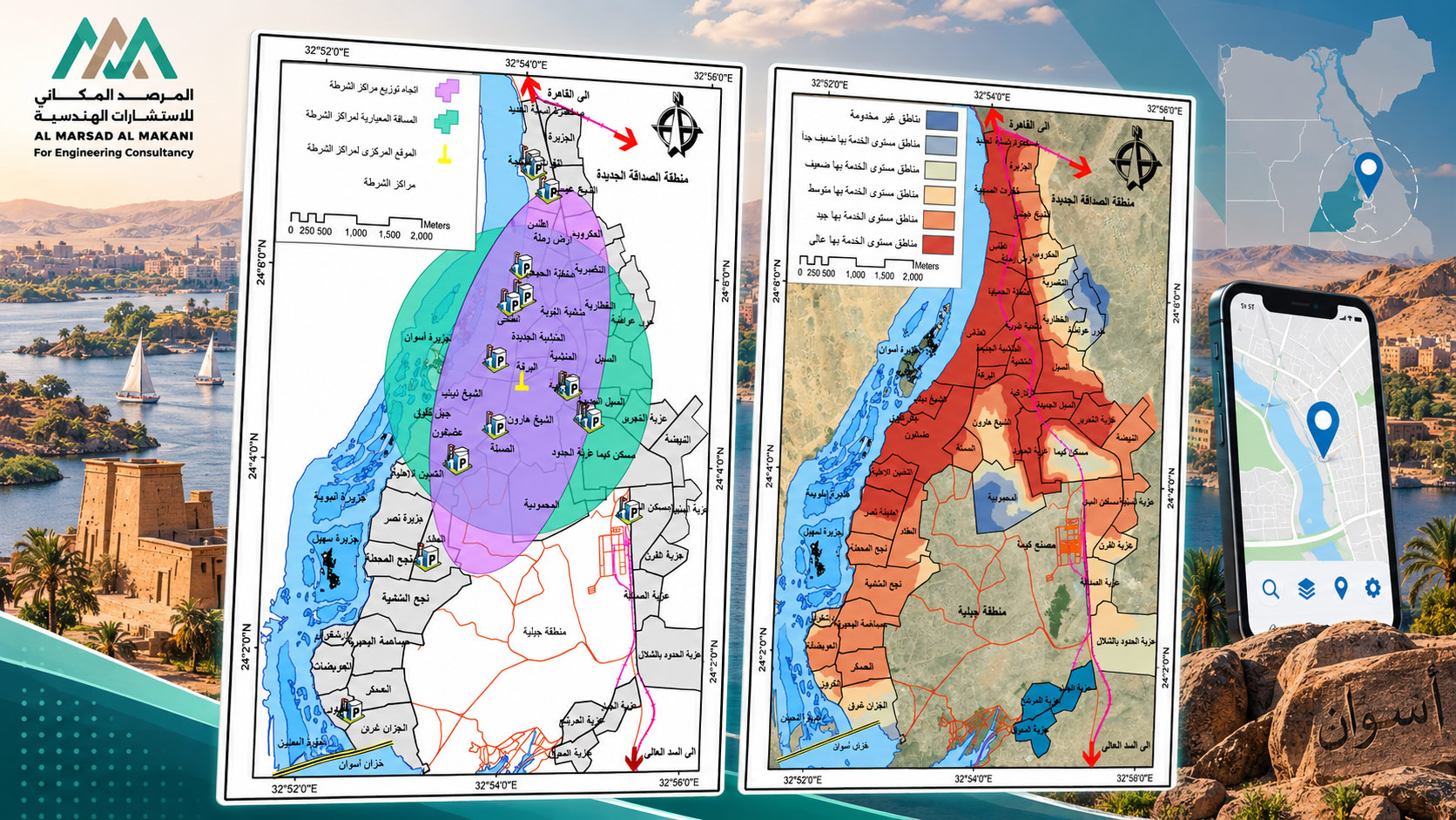
Development of a Spatial Services Assessment Application for Aswan City
- Project TypeGIS Application for Assessing the Efficiency and Equity of Service Distribution
- LocationAswan City – Arab Republic of Egypt
- Project DescriptionA project to assess the efficiency and equity of service distribution across Aswan City and identify service gaps and future needs. The scope included collecting and preparing spatial and descriptive data, developing a Geodatabase, and performing GIS-based spatial and statistical analyses covering service areas, accessibility, proximity, density, and service gaps. The project also included preparing performance indicators and service evaluation maps, identifying development priorities, and developing an interactive GIS application to present results and support planning and decision-making.
Advanced geospatial solutions for analyzing cities, services, and resources, while supporting planning and decision-making.
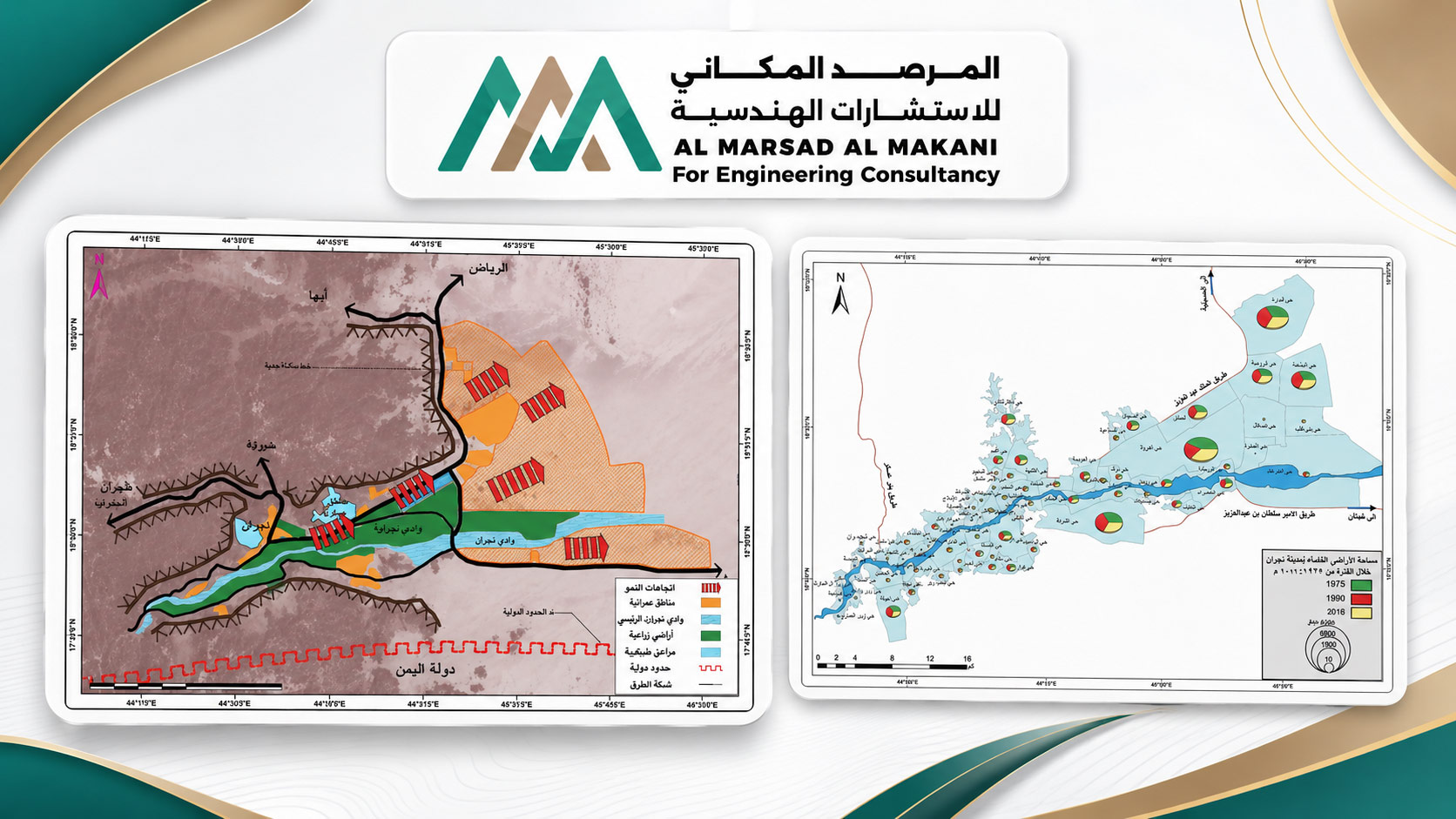
Spatial Change Analysis of Land Use in Najran City Using Remote Sensing and Geographic Information Systems
- Project TypeRemote Sensing – Change Detection – LULC.
- LocationNajran – Kingdom of Saudi Arabia
- Project DescriptionA project focused on monitoring and analyzing spatial changes in land use across Najran City over different time periods and assessing urban expansion patterns and their impacts on natural resources. The study involved processing multi-temporal satellite imagery and Landsat data and applying LULC Analysis, Image Classification, and Change Detection, together with elevation models, road networks, administrative boundaries, and planning datasets. The project also included analyzing urban expansion and growth trends and producing maps of land-use and land-cover changes, urban expansion patterns, spatiotemporal change indicators, and an integrated GIS geodatabase.