





Integrated solutions for topographic surveying, construction surveying, Geographic Information Systems, and 3D laser scanning.
Examples of Land Surveying, Topographic Surveying, and 3D Scanning Projects
This portfolio includes a diverse range of specialized projects covering land surveying, topographic surveying, geomatics, ground control points, construction setting-out, preparation of sections, digital models, and maps, as well as 3D laser scanning. The projects covered the Holy Sites, housing developments, urban development projects, and industrial facilities, reflecting the wide range of surveying applications in supporting design, construction supervision, boundary determination, and the production of accurate spatial data required throughout different project stages.
The work included detailed topographic surveys, establishment and verification of horizontal and vertical control points, setting out engineering elements on site, preparation of contour lines, As-Built drawings, longitudinal and cross sections, and digital terrain models. It also covered the delivery of outputs in GIS formats, calculation of cut-and-fill quantities, and development of AutoCAD and GIS databases.
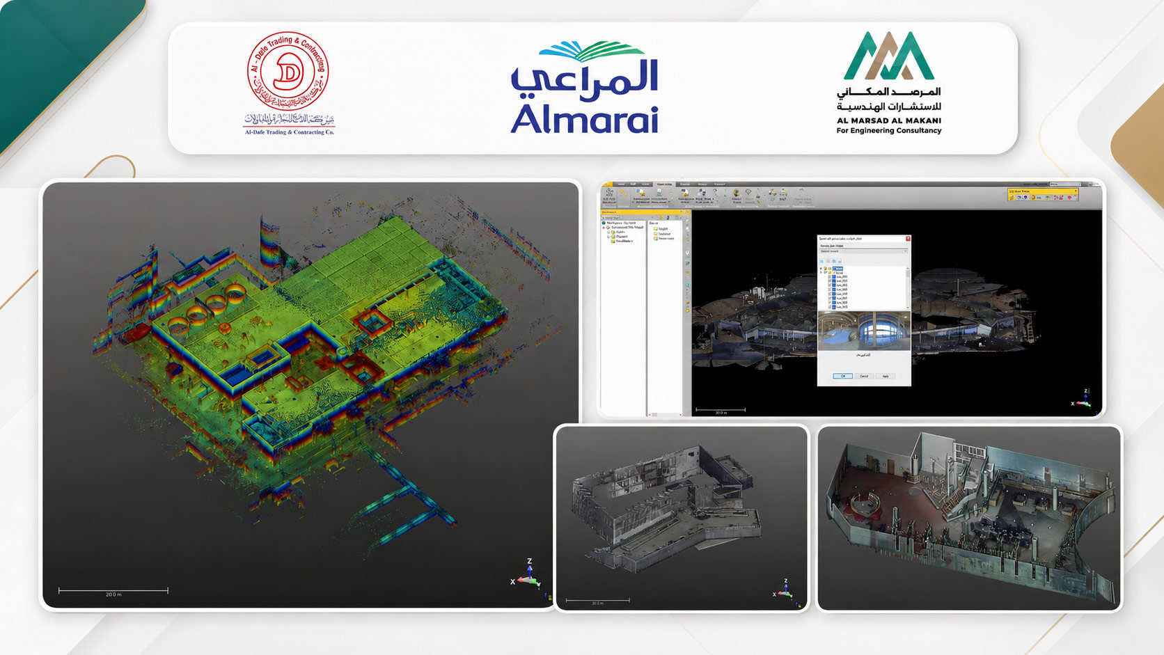
The portfolio also includes the application of 3D laser scanning technologies for data acquisition, processing, and verification, leading to the production of highly accurate digital models of structures and facilities.
Integrated solutions for topographic surveying, construction surveying, Geographic Information Systems, and 3D laser scanning.
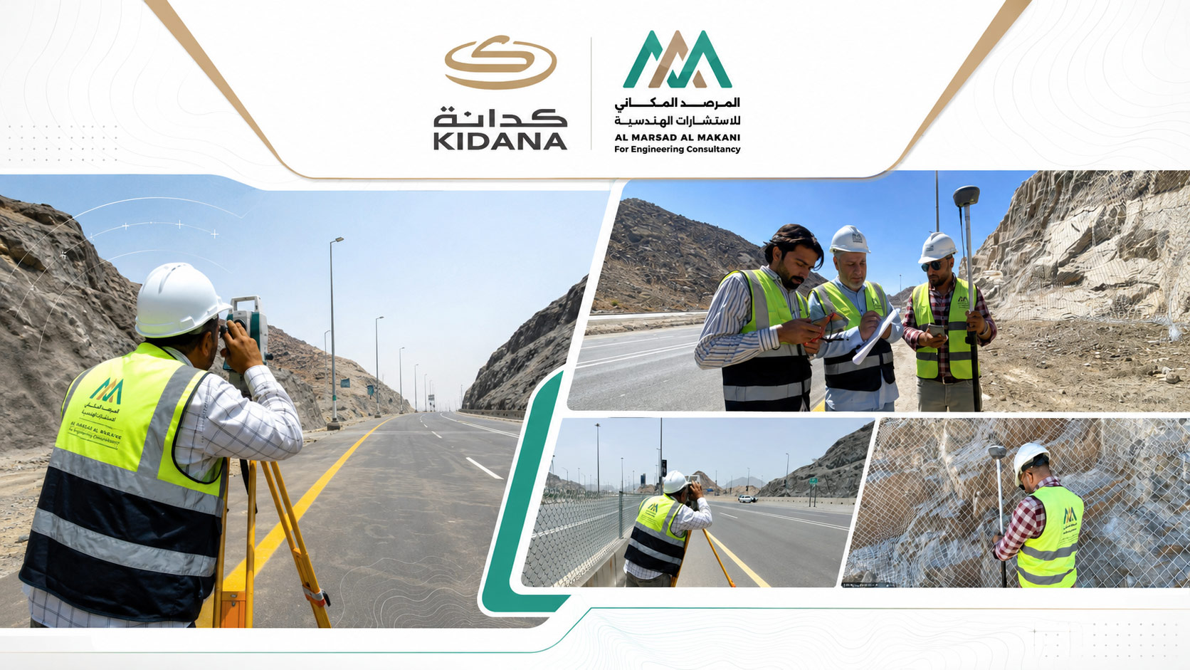
Topographic Surveying Works for Supervising the Implementation of the Natural Hazard Protection Project in the Holy Sites
- Project TypeTopographic Surveying and Support for the Supervision and Implementation of Natural Hazard Protection Structures
- LocationHoly Sites – Makkah – Kingdom of Saudi Arabia
- ContractorKIDANA
- ConsultantKIDANA
- Project DurationTwo Months
- Sub-ConsultantAl Marsad Al Makani for Engineering Consultancy
- Project DescriptionThe project included detailed topographic surveying of areas exposed to rockfall hazards and the locations of protection structures throughout the Holy Sites. The scope covered the establishment and verification of horizontal and vertical control points, as well as the setting out of protection elements such as retaining walls, rockfall barriers and mesh systems, and rock bolts. The works also supported the supervision team through the verification of alignments, levels, and dimensions, preparation and calculation of excavation, cut, and fill quantities, and production of As-Built survey drawings and reports. The scope further included DTM works, longitudinal and cross sections, and digital models required to support the implementation and supervision of the protection works.
Integrated solutions for topographic surveying, construction surveying, Geographic Information Systems, and 3D laser scanning.
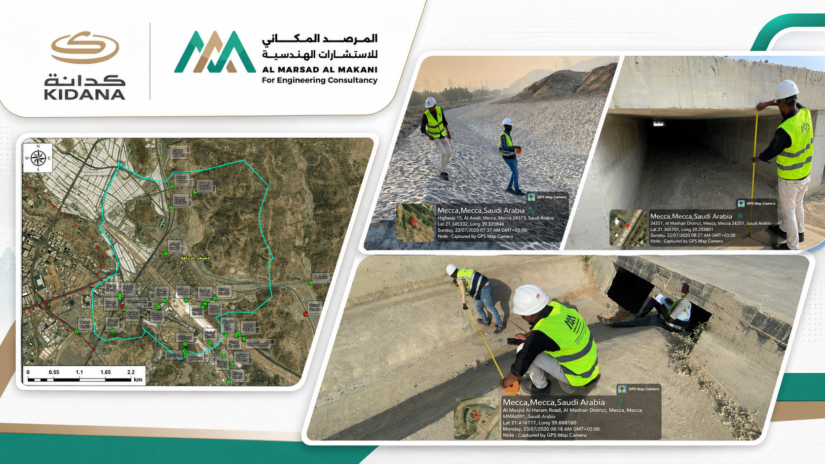
Topographic Surveying Works for Flood Protection Structures in the Holy Sites
- Project TypeTopographic Surveying and Survey Support for Flood Protection Structures
- LocationHoly Sites – Makkah
- ContractorKIDANA
- ConsultantKIDANA
- Project DurationOne Month
- Sub-ConsultantAl Marsad Al Makani for Engineering Consultancy
- Project DescriptionThe project involved carrying out the surveying works required for flood protection structures throughout the Holy Sites. The scope included detailed topographic surveying, establishment and adjustment of control points, setting out of engineering elements, quantity calculations, and preparation of engineering As-Built drawings. The works also included verifying alignments, levels, and dimensions during construction, preparing longitudinal and cross sections, developing digital terrain models, and producing the maps and technical reports required for the project.
Integrated solutions for topographic surveying, construction surveying, Geographic Information Systems, and 3D laser scanning.
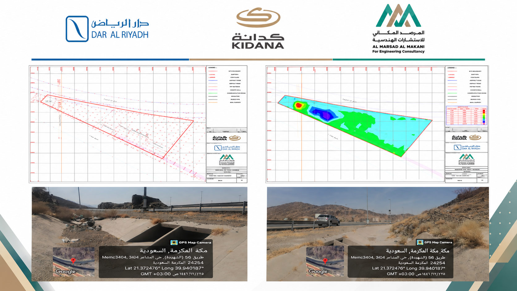
Topographic Surveying for the Design of Rest Areas in the Holy Sites – Rest Area No. 1
- Project TypeTopographic Surveying to Support Design Works
- LocationHoly Sites – Makkah
- ContractorKIDANA
- ConsultantDar Al Riyadh
- Project DurationOne Month
- Sub-ConsultantAl Marsad Al Makani for Engineering Consultancy
- Project DescriptionThe project involved carrying out a topographic survey for Rest Area No. 1 as part of the design project for rest areas in the Holy Sites. The scope included field data collection, establishment of survey control points, preparation of topographic plans and elevation data, development of digital models, and production of the surveying deliverables required to support the design works. The project documentation also presents samples of analytical maps, engineering drawings, and field photographs produced during the survey activities.
Integrated solutions for topographic surveying, construction surveying, Geographic Information Systems, and 3D laser scanning.
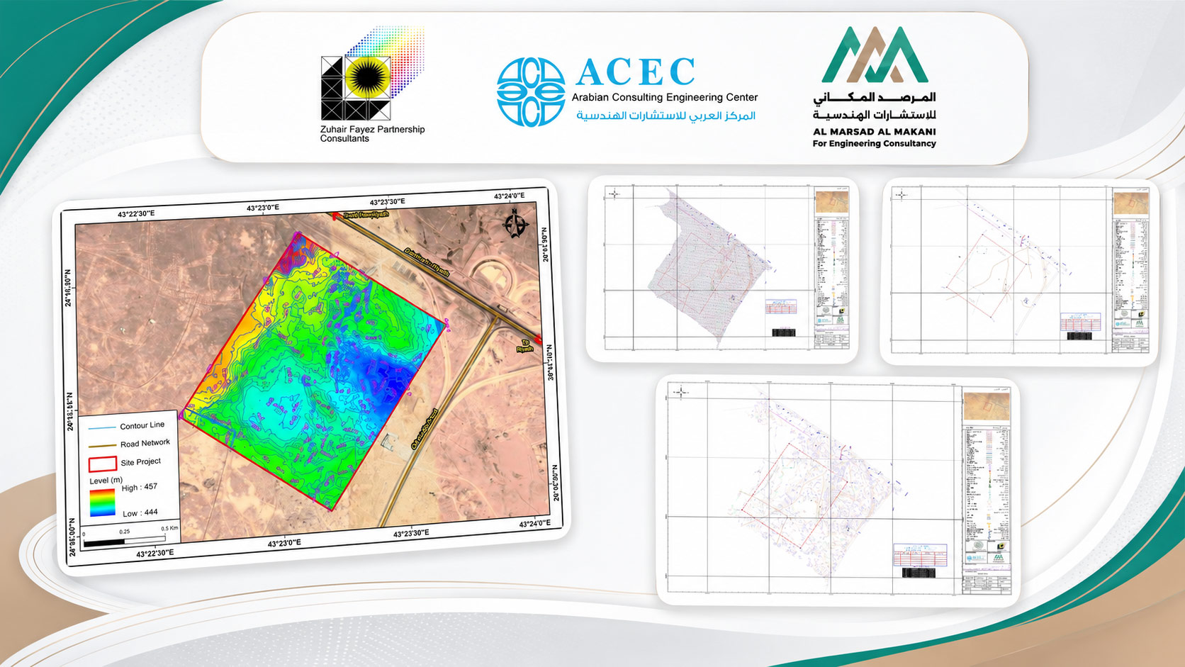
Surveying Works for the Armed Forces Housing Design Project – Rafha Site
- Project TypeTopographic Survey, Boundary Delineation, and Spatial Database Development
- LocationRafha – Kingdom of Saudi Arabia
- ContractorArab Consulting Engineers Center (ACEC)
- ConsultantZuhair Fayez Partnership Consultants.
- Sub-ConsultantAl Marsad Al Makani for Engineering Consultancy
- Project DurationOne Week
- Project DescriptionThe project involved carrying out the surveying works required for the design of the Armed Forces Housing Project at the Rafha site. The scope included defining and setting out the project boundaries, verifying title deeds against actual site conditions, and establishing, processing, and correcting ground control points. The works also included a detailed topographic survey of the project boundaries and the surrounding area up to a distance of 200 meters, preparation of a survey control network and contour lines at 1-meter vertical intervals, and documentation of the site, existing structures, and features using GIS. The final deliverables were provided in GIS and AutoCAD formats, together with the development of a comprehensive spatial database for the project.
Integrated solutions for topographic surveying, construction surveying, Geographic Information Systems, and 3D laser scanning.
Surveying Works for Crown Prince Development Project No. 9 – Section H – Makkah Region
- Project TypeTopographic Surveying, Boundary Delineation, and GIS Data Preparation
- LocationMakkah Region
- OwnerMinistry of Housing
- ConsultantOmrania & Associates Engineering Consultant.
- Sub-ConsultantAl Marsad Al Makani for Engineering Consultancy
- Project DurationOne Week
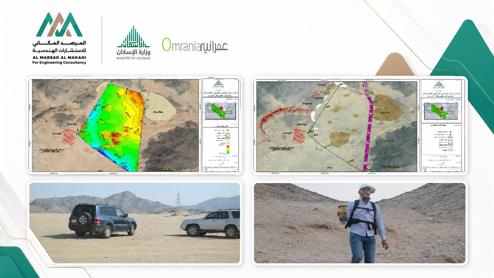
- Project DescriptionThe project included boundary setting-out and verification of title deeds against actual site conditions, as well as the establishment and correction of ground control points. The scope also included carrying out a detailed topographic survey for Crown Prince Development Project No. 9 – Section H, covering the site boundaries and surrounding areas, establishing a survey control network, and preparing contour lines at 1-meter intervals. The works further included documenting existing features and structures, developing a comprehensive GIS spatial database, and preparing and delivering various project outputs using GIS and AutoCAD.
Integrated solutions for topographic surveying, construction surveying, Geographic Information Systems, and 3D laser scanning.
Surveying Works for Crown Prince Development Project No. 9 – Section D – Makkah Region
- Project TypeTopographic Surveying and Preparation of Maps and Spatial Data
- LocationMakkah Region
- OwnerMinistry of Housing
- ConsultantOmrania & Associates Engineering Consultant.
- Sub-ConsultantAl Marsad Al Makani for Engineering Consultancy
- Project DurationOne Week
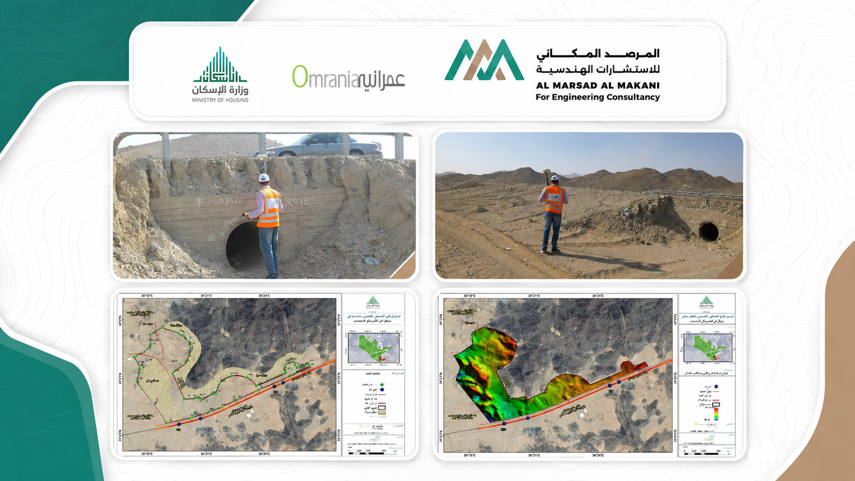
- Project DescriptionThe project began with defining and setting out the site boundaries, verifying title deeds against actual site conditions, and establishing and correcting survey control points. The scope then included carrying out detailed topographic surveying works for Crown Prince Development Project No. 9 – Section D, preparing and delivering all GIS outputs, establishing the survey control network and contour lines, and documenting the site, surrounding features, and existing structures. The works concluded with the development of a comprehensive spatial database and the preparation of the required maps and models in GIS and AutoCAD formats.
Integrated solutions for topographic surveying, construction surveying, Geographic Information Systems, and 3D laser scanning.
Surveying Works for Crown Prince Development Project No. 9 – Section Z – Makkah Region
- Project TypeTopographic Surveying, Boundary Delineation, and Spatial Database Development
- LocationMakkah Region
- OwnerMinistry of Housing
- ConsultantOmrania & Associates Engineering Consultant.
- Sub-ConsultantAl Marsad Al Makani for Engineering Consultancy
- Project DurationOne Week
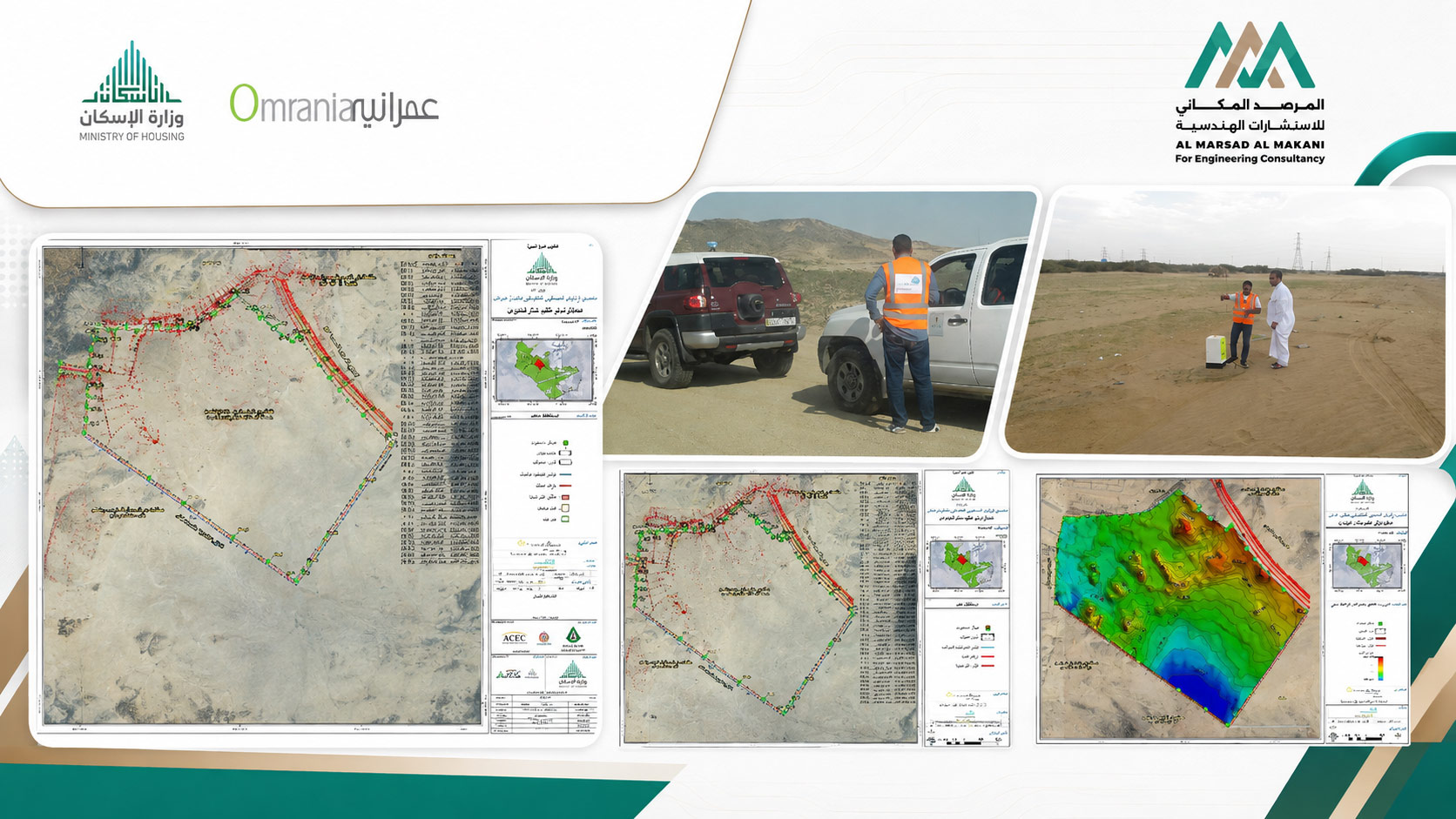
- Project DescriptionThe project included defining and setting out the site boundaries, verifying their conformity with actual site conditions and title deeds, establishing survey control points, and carrying out the surveying works required for Crown Prince Development Project No. 9 – Section Z. The scope also included detailed topographic surveying, preparation of GIS outputs, survey grids and contour lines, field documentation, and identification of existing features and structures within the site and its surrounding area. The works concluded with the development of the required spatial database and preparation of project deliverables in GIS and AutoCAD formats.
Integrated solutions for topographic surveying, construction surveying, Geographic Information Systems, and 3D laser scanning.
3D Laser Scanning Survey for Almarai Factory – Al Kharj
- Project Type3D Laser Scanner Survey
- OwnerAlmarai
- LocationAl Kharj – Kingdom of Saudi Arabia
- ConsultantAl-Dafe Trading & Contracting.
- Sub-ConsultantAl Marsad Al Makani for Engineering Consultancy
- Project DurationOne Week
- Project DescriptionThe project involved carrying out 3D laser scanning works for the Almarai Factory in Al Kharj. The scope included site reconnaissance, preparation of the data collection plan, and implementation of Data Acquisition activities. The collected data was then processed, verified, and refined before preparing and exporting the final deliverables and technical report. The project documentation presents samples of the resulting 3D digital models produced for the facilities and structures within the factory site.